1.9Mviews256×
Posted Sep 25, 2026
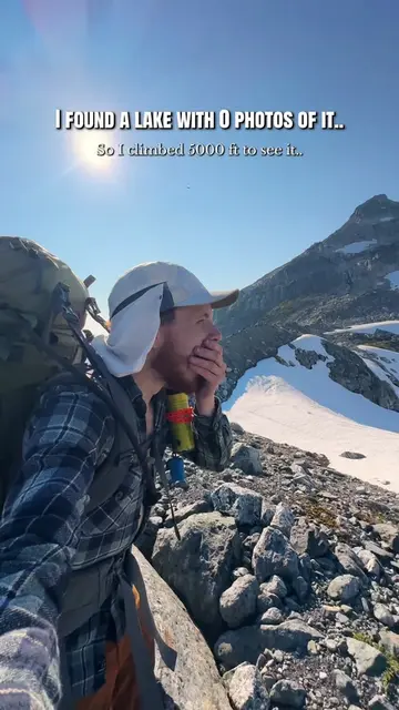
🌎 I couldn’t find a single photo of this lake online... so I loaded up a 55 lb pack and bushwhacked 5,000 ft up a mountain to see it for myself. I spotted this tiny unnamed lake on Google Earth while searching for photography locations near Squamish BC. It sits just below Zig-Zag Peak, and even from satellite imagery it looked absolutely insane. Hours of searching turned up no photos taken from the lake and almost nothing about how to actually reach it. That was enough convincing for me. It was only about 2.4 miles from the road on the map. The catch was nearly 5,000 vertical feet of mountain and absolutely no trail. So I packed three nights of camping gear, about 20 lbs of camera equipment, and started heading straight up. 8 hours 16 minutes, 3.4 miles and 5,284 ft of elevation gain later, I finally got my first look. And somehow it was even crazier than I expected. The lake basically looks like an infinity pool perched on the mountain, with glaciers and huge peaks all around it. Even in August it was still mostly frozen. I ended up spending three nights camped up there, trying to photograph as much as I could. It’s honestly hard to show how massive this place feels when you’re actually standing there. I haven’t found an official name for it, so “Zig-Zag Lake” is what I’ve been calling it. Here’s the adventure that got me there, including that first look and some of the photos I came home with at the end. 👀 All that bushwhacking for a lake I’d only seen on Google Earth. Would you send this? #mountainphotography #mountaineering #britishcolumbia #backpacking #squamish
See the breakdown